Lofoten Islands

Panoramic view of Kjerkfjorden and the fishing village of Reine, on Moskenesøya island, part of the Lofoten Islands of northern Norway.
For the last week or so I’ve been doing my thing here on Moskenesøya, one of the Lofoten Islands, with some of the most unique and incredible landscapes on Earth! The mountains soar up right out of the ocean, with sheer granite faces leading to symmetrical pointy summits. The mountains are covered in lush green tundra, and there are also lots of fjords, lakes, and even some beaches!

The fishing village of Reine is on Moskenesøya Island, perhaps the most rugged and impressive of the Lofoten Islands. This rare calm day provided the opportunity I was hoping for to photograph the reflection of the village and the massive peak behind it. Every person around here this morning was just in awe of the scene.
There are also lots of tourists, at least compared to the other places I’ve been in Norway so far. All the little fishing village cabins are occupied (not that I could afford those anyways), so I’ve mostly just been camping out. Usually I just find a spot off the road and pitch my tent, and every third or fourth day I stay in a real campground so that I can restock my supplies and take a shower. I’ve realized though that the key to camping here is to be willing to walk and camp just a short distance from the car. The roads here pass by so many awesome cirques, many of them with lakes, and by walking just a little ways, like maybe just a few hundred meters, you can camp in places that would be worthy destinations in the most remote mountains of the world.
A few nights ago I spent a couple nights camped on a little peninsula that jutted out into an emerald lake surrounded by a towering cirque that looked like something you’d find in the Wind River Range of Wyoming. I was so absorbed in the scenery I felt like I was deep in alpine wilderness; a seagull passing by snapped me back to the reality of the location, then I looked back to see my car about 150 meters away! Unreal.

Misty campsite near Flakstad.

Sunrise light shines on a random cirque on the island of Flakstadøy, part of the Lofoten Islands of Norway.
I also made an expedition to watch the sunset from Hermannsdalstinden, the tallest peak on this island at 1027m. The hike was pretty tough, with lots of ups and down, ending in a really steep and exposed scramble up the summit ridges and boulders. The view from the top, though, was perhaps the most wildly rugged mountain vista I’ve ever laid eyes on, all rising right up out of the sea. I hiked down in the bright twilight after the sunset, and the sun started rising just as I got back to camp. I’m loving these long arctic days.
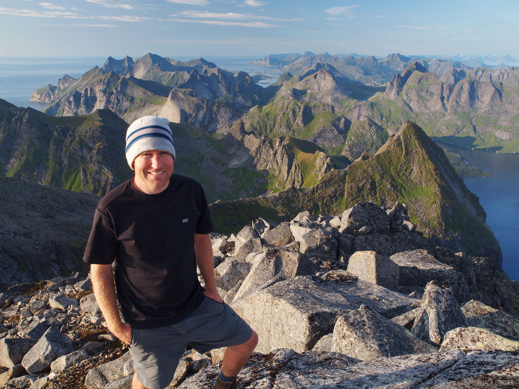

A spectacular sunset over the Lofoten Islands, as seen from the summit of Hermannsdalstinden (1029m), the tallest mountain on Moskenesøya Island.

In the middle of the night in July north of the Arctic Circle, sunset and sunrise blend together seamlessly. This is about as dark as it gets. I took this photo on the way down from Hermannsdalstinden mountain at about 1:00 at night
There's a natural optical illusion in this photo: Though it almost looks like one body of water here, the lake pictured in the center is actually 1,000 feet higher than the fjord behind - with a sheer drop and waterfall in between.
Finally, I backpacked to Bunes beach and camped there for the night. It’s a large sandy beach surrounded on both sides by towering granite peaks… really a unique place.

Morning at Bunes Beach on Moskenesøya Island - July.
Now I’m slowly making my way north through the Lofoten Islands; my plan is to eventually end up at Tromsø and check out the wild mountains around there.